Terrain for AutoCAD v.1.0
Advertisement
Description
Terrain for AutoCAD is a terrain modeling plug-in for AutoCAD. This plug-in gives AutoCAD the ability to create a terrain mesh from a set of unordered points. The terrain mesh is created as a Delaunay Triangulation, which is regarded as the best method to create a terrain mesh from unorganized point data. Terrain for AutoCAD can also import a set of points from a text file containing point coordinate data along with point numbers and point...
Read more
- Rate:
- Release Date:02/23/2012
- License:Commercial
- Category:CAD
- Developer:SYCODE
- Downloads:123
- Size:1.73 Mb
- Price: $95.00
To free download a trial version of Terrain for AutoCAD, click here
To visit developer homepage of Terrain for AutoCAD, click here
Advertisement
System Requirements
Terrain for AutoCAD requires Win95, Win98, WinME, WinNT, 3.x, WinNT, 4.x, Windows2000, WinXP, Windows2003.
Terrain for AutoCAD v.1.0 Copyright
Shareware Junction periodically updates pricing and software information of Terrain for AutoCAD v.1.0 full version from the publisher using pad file and submit from users. Software piracy is theft, Using crack, password, serial numbers, registration codes, key generators, cd key, hacks is illegal and prevent future development of Terrain for AutoCAD v.1.0 Edition. Download links are directly from our publisher sites. Links Terrain for AutoCAD v.1.0 from Bittorrent, mediafire.com, uploadfiles.com, hotfiles.com rapidshare.com, megaupload.com, netload.in, storage.to, depositfiles.com and other files hosting are not allowed. The download file is obtained directly from the publisher, not from any Peer to Peer file sharing applications such as Shareaza, Limewire, Kazaa, Imesh, eDonkey, eMule, Ares, BearShare, Overnet, Morpheus, BitTorrent Azureus and WinMX.
Review This Software
More Terrain for AutoCAD Software
Advertisement
ArcGIS for AutoCAD v.3.0.210
ArcGIS for AutoCAD is a free, downloadable plug-in application for AutoCAD that provides improved interoperability between AutoCAD and ArcGIS. Within the AutoCAD environment, you gain easy access to enterprise GIS maps hosted by ArcGIS Server.
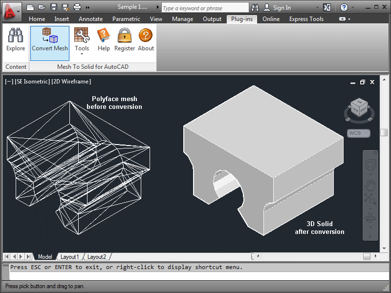
Mesh To Solid for AutoCAD v.1.0
Mesh To Solid for AutoCAD is a polygon mesh to 3d solid conversion plug-in for AutoCADT«.
3DM Import for AutoCAD v.1.0
3DM Import for AutoCAD is a RhinocerosT« 3DM file import plug-in for AutoCADT«.
Terrain Tool for AutoCAD v.1.2
Terrain Tool offers a strong way of designing, analyzing and presenting terrains in AutoCAD. It was developed with the needs of architects and landscape architects in mind.
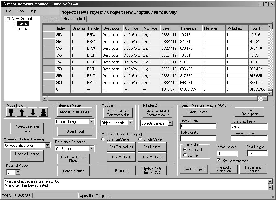
InnerSoft CAD for AutoCAD 2013 v.2.9.0
InnerSoft CAD is an add-on for AutoCAD that installs a set of productivity tools for Civil and Survey, Counting, Estimating and measurements in construction project budgets.
InnerSoft CAD for AutoCAD 2014 v.3.0
InnerSoft CAD is a plug-in for AutoCAD that install a set of productivity tools for Civil and Survey, Counting, Estimating, export to MS Excel, import from Excel, measurements in construction project budgets.
GrSoft Smart Tools X for AutoCAD
GrSoft Smart Tools X for AutoCAD offers very effective user interface, making the basic AutoCAD commands rapid and easy to use, working as classic toolbar. Basic AutoCAD commands are accessible through user friendly dialogs, where you can easily define
Systematized programs for AutoCAD from CADALYST
Systematized LISP programs and hatch patterns for AutoCAD from CADALYST. Menu generator. SELECT ...CADALYST.EXE IF DOWNLOAD SCREEN (RUSSIAN ENCODING) IS APPEAR or visit home page.
InnerSoft CAD for AutoCAD 2007 v.1 2
InnerSoft CAD is a add-on for AutoCAD. This group of tools will allows you to: Export to a Excel Sheet the values of Area/Length property or coordinates for various AutoCAD entities.
InnerSoft CAD for AutoCAD 2006 v.1 2
InnerSoft CAD is a add-on for AutoCAD. This group of tools will allows you to: Export to a Excel Sheet the values of Area/Length property or coordinates for various AutoCAD entities.
InnerSoft CAD Demo for AutoCAD 2011 v.1 6
InnerSoft CAD is a add-on component for AutoCAD that allows you to Export the values of an Area/ Length property or coordinates to an Excel Sheet. Take measurements on AutoCAD for construction project budgets.
Other products of this developer SYCODE
3DM Export for SpaceClaim v.1.0
SpaceClaim already has the ability to export to ...onvert solids into polygon meshes in a 3DM file.
3DM Import for AutoCAD v.1.0
3DM Import for AutoCAD is a RhinocerosT« 3DM file import plug-in for AutoCADT«.
DXF Export for Solid Edge v.1.0
DXF Export for Solid Edge is an AutoCADT« DXF file export add-in for Solid EdgeT«.
DXF Export for SolidWorks v.1.0
DXF Export for SolidWorks is an AutoCADT« DXF file export add-in for SolidWorksT«.